The Latest Buzz
Accurate Underwriting: Fresh Map Imagery for Commercial Property Analysis

Hivemapper’s data products provide insurers with up-to-date imagery and insights for precise risk assessment.
Commercial property insurers can struggle with accurately assessing risk profiles due to a reliance on outdated information and a lack of comprehensive insights into the surroundings of the properties. Limited visibility into building conditions, local area hazards, and suitability for business operations can make pricing commercial policies difficult, potentially exposing insurers to unforeseen losses and leaving property owners with misaligned premiums.
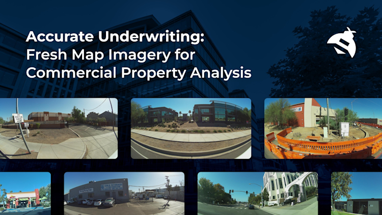
Hivemapper’s map data products offer an innovative solution for commercial insurance underwriting, powered by a mapping network that continuously captures fresh, standardized street-level imagery.
By integrating this imagery via the Map Image API, remote loss control surveys become more efficient and insightful, enabling underwriters to cover a wider area and collect more data for accurate assessments. Underwriters access expansive views that can reveal exterior risks at specific locations, from structural defects to proximity hazards. Insurers can also get a clearer picture of a particular area’s safety profile by incorporating the Map Features API to access nearby features like speed limits, street signs, and traffic lights.
Visit our product page and contact sales to learn more. To get started, generate an API key. Hivemapper’s tools can help insurers achieve more accurate and fair policies, enhancing their service value and reliability in the commercial property market.
Precise Property Evaluation
Hivemapper’s up-to-date, detailed imagery of commercial properties allows for a more accurate assessment of their condition, surrounding areas, and potential hazards. For instance, the presence of large trees, the condition of neighboring buildings, or proximity to hazardous zones can be evaluated more thoroughly.
Dynamic Risk Profiling
By continuously collecting fresh imagery, Hivemapper ensures that insurers have the latest information. This is crucial for dynamic risk profiling, as the risk associated with a property can change over time due to factors like new construction, environmental changes, or neighborhood evolution. Multi-date captures track changes over time.
Safety and Compliance Analysis
Insurers can use the Map Features API to assess the safety aspects surrounding a commercial property. Data on traffic signs and signals can help evaluate the area’s adherence to road safety, which is an essential factor in risk assessment. Well-regulated traffic, indicated by traffic control features, reduces risks from accidents and incidents. Businesses situated on hazardous corridors or intersections can have policies adjusted accordingly.
Targeted Data Collection
Insurers can use Hivemapper’s Bursts feature to incentivize the collection of fresh data in areas of interest, such as high-risk zones or regions with sparse data. This targeted approach ensures that underwriters have access to the most relevant and up-to-date information. They can build a more detailed and accurate understanding of the risks associated with particular properties or areas, leading to more precise underwriting.
Tracking Changes Over Time
Scout, Hivemapper’s location monitoring tool, allows for the tracking of specific locations for changes and updated imagery. This is critical in understanding how a property and its surroundings evolve, impacting its risk assessment. Regular updates on new construction or alterations in the neighborhood help insurers proactively manage risks and adjust policies accordingly. Scout enables insurers to keep an eye on the state of multiple properties at once.
Hivemapper’s location-specific imagery and data support the underwriting of commercial policies that are tailored to asset safety and exposure realities. Building a comprehensive data foundation that can help map property conditions, traffic patterns, and potential hazards at scale enables insurers to migrate from proxy-based rating factors to highly individualized premiums that more accurately reflect risk.
Insurers gain an automated and versatile data solution for augmented underwriting. Integrating Hivemapper unlocks unparalleled visibility into location-based profiles, enabling smarter policies that are both profitable and fair.**
Follow us on X (Twitter) and join our Discord.
Share Post


